Difference between revisions of "San Ysidro"
| Line 29: | Line 29: | ||
|- | |- | ||
| | | | ||
| − | + | * [[Anarch]] - The small border community is rumored to hold a small safehouse where individuals and packs can rest before traveling between California and Baja California | |
|} | |} | ||
{| width="100%" cellpadding="2" cellspacing="5" | {| width="100%" cellpadding="2" cellspacing="5" | ||
| Line 36: | Line 36: | ||
|- | |- | ||
| | | | ||
| − | + | * The San Ysidro Branch Library. | |
| + | * Parks include Howard Lane Park, Vista Terrace Park, and San Ysidro Community Park. | ||
| + | * Churches include Our Lady of Mount Carmel Roman Catholic Church. | ||
| + | * The San Ysidro Post Office opened on April 13, 1910. | ||
| + | * The San Ysidro U.S. Inspection Station/U.S. Custom House is listed on the National Register of Historic Places. | ||
| + | * Prospect's largest outlet mall is on the international border immediately west of the crossing, Las Americas Premium Outlets, with 125 stores. | ||
| + | * Noted architect Louis John Gill designed the Spanish Revival-style building at 147 W. San Ysidro Blvd. | ||
|} | |} | ||
| Line 72: | Line 78: | ||
|- | |- | ||
| | | | ||
| − | + | San Ysidro is named for San Ysidro Labrador (Saint Isidore), patron saint of farmers. After independence from Spain in 1822, the Mexican government started issuing land grants for ranchos. In 1829 it granted Santiago Argüello Moraga the 10,000-acre Rancho Tía Juana, which covered parts of what now are San Ysidro and Tijuana. After the 1846 Mexican–American War, Mexico ceded what is now the Southwest U.S. in 1848. San Ysidro found itself on an international border. The border was marked in the mid-1860s and the first customs building was erected in 1873. The border was unfenced until one was built in 1910 from the Pacific Ocean to Otay Mountain. With the rise of Tijuana, Mexico as a racing, gambling, drinking and entertainment destination in the 1920s, many American employees of these establishments lived in San Ysidro and worked in Tijuana. | |
| + | |||
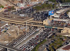
| + | San Ysidro is home to the fourth busiest land border crossing in the world, where U.S. Interstate 5 crosses into Mexico at Tijuana. It is the busiest border crossing in the United States, and the busiest in the Western Hemisphere according to the U.S. government. | ||
|} | |} | ||
{| width="100%" cellpadding="2" cellspacing="5" | {| width="100%" cellpadding="2" cellspacing="5" | ||
Revision as of 15:41, 4 April 2020
|
| ||||||||||||||||||||||||
| |||||||||||||||||||||||||

